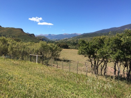
The Cucharas (Spoons) River flows north to La Veta. The Purgatoire (Purgatory) River flows south to Trinidad. Their waters will never meet. Spoons will not go to Purgatory.
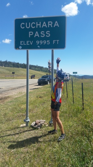
La Veta and Trinidad are separated by Cuchara Pass. Today I went over the pass. The ascent was not on my radar but it should have been. It was as difficult as Wolf Creek Pass, just four miles long instead of eight.
The transition of SAG went splendidly. Susie is a master teacher and my brother, Mike, is a quick study. After lunch at the Stonewall Shopping Bag during the long descent from Cuchara Pass, we encountered a brief thunderstorm. Mike and I loaded the bike into the car in a snap and I took a short nap while the storm passed over.
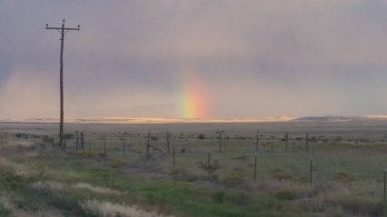
By the end of the day, the transition from mountains to plains was complete. Cuchara Pass would be my last mountain climb in the West. I won’t see any more mountain climbs until I am back east in the Appalachians.
Expect the Unexpected, continued: This morning, our B&B hostess suggested a short drive to see the lava dikes emanating from the Spanish Peaks. I wanted to see them so Mike and I went, even though we knew we would be delaying the start of a long ride. Afterwards we went back to town to seek Wifi so I could post my blog called Transitions. I preferred the library but it wasn’t open yet. Mike pointed out the coffee shop across the street. There was a parking spot right in front but Mike suggested I just go in. I’d been there about 10 minutes (in my cycling clothes) when a couple came in. The athletic wife came straight over to me and started talking. Within minutes, she learned that I was on a cross country ride. She wondered if my route would go through Ulysses where they lived, and if it did, would we like to stay at their house. That’s where we’ll stay on Sunday! Had we not gone to see the dikes or had the library been open or had we used the outside parking space, I’d not have met Yolanda and Bill. Bizarre.
Ride details
Start location: La Veta CO
End location: 15 miles past Trinidad CO on the way to Springfield CO
Distance: 80 miles
Cumulative distance: 1177.2 miles
Elevation gain: 4311 feet
Cumulative elevation gain: Almost 50,000 feet!
Strava track: https://www.strava.com/activities/714801443

It’s so cool how every day of your adventure seems to have surprises. Must be a reflection of the way you exist On earth.
LikeLike
Jenn, It’s a lovely phenomenon but I think it has more to do with bike touring than me personally. It’s common enough to have a name— trail angels. Have you ever experienced it?
LikeLike
Thanks Mike and Sandra for helping Lynn! What happened to David? I thought he was joining.
LikeLike
David helped me out on Wolf Creek Pass along with Susie, then he took Susie to the Denver airport so she can go home for some R&R. Mike’s been with me for a few days. Sandra takes over on Monday.
LikeLike
Lynn: Your incredible journey continues! Thanks so much for the beautiful pix!
LikeLiked by 1 person
Lynn, we are enjoying your journey along the RAAM route across America. My family has followed RAAM and have cycled portions of it. You just passed a very significant yet tragic spot along RAAM route. Back in 2005 ultra cyclist Bob Breedlove sadly was killed just outside Stonewall, Colorado on this very section you just completed. I have been at the site and there is a small white cross just off the road along fencepost. This link will take you to the Outside Magazine article that was published about this accident. Enjoy your journey but be careful ans stay safe out there!
http://www.outsideonline.com/1927891/wrecked
LikeLike
I was so sorry to read of that terrible event. I did not see the memorial to Bob Breedlove when I cycled there.
I am so glad that I am just riding and not racing the RAAM route. It’s a fabulous route and I am savoring it — and being careful.
LikeLiked by 1 person
Congratulations on yet another amazing milestone! You are so strong!
LikeLike
Thanks, Robin! You are all with me! Did you see I wore the Babes jersey for Wolf Creek Pass?
LikeLike